


Cube4EnvSec Demonstrations
By using the service you accept the Cube4EnvSec Terms & Conditions.
Aviation Safety Demonstrator
Contributing federation nodes: |
Arctic Environmental Monitoring
Contributing federation nodes: |
Contact us for your individual demonstration!
All Cube4EnvSec Contributions
Each of the international project partners has addressed a focused use case. All of them have finally been federated, and the two above overarching demos have been amalgamated.


Note: there are known issues with Firefox, if the selection does not display use these links:
[ rasdaman datacubes
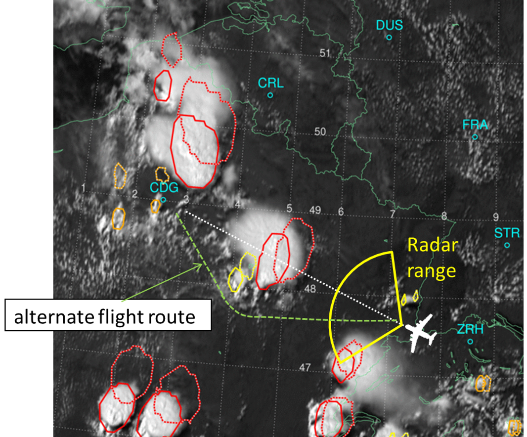
- Aviation weather
- Arctic Environmental Monitoring
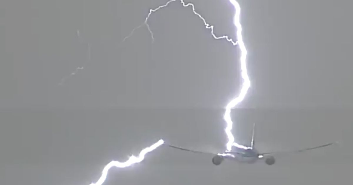
- Lightning
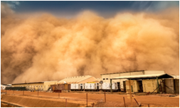
- Aviation Ash & Dust Hazard
- AI-Cubes™
- ChatCUBE
- Cloud/Edge Integration
]
News
About Cube4EnvSec
Capability Gap
"Working off the same map and sharing it" and "the right data, at the right time, in the right format" is required for any orchestrated activity in Transnational Security and Environment Protection, in particular the NATO Federated Mission Network (FMN). The corresponding capabilities are not available today to the extent needed.
Mission
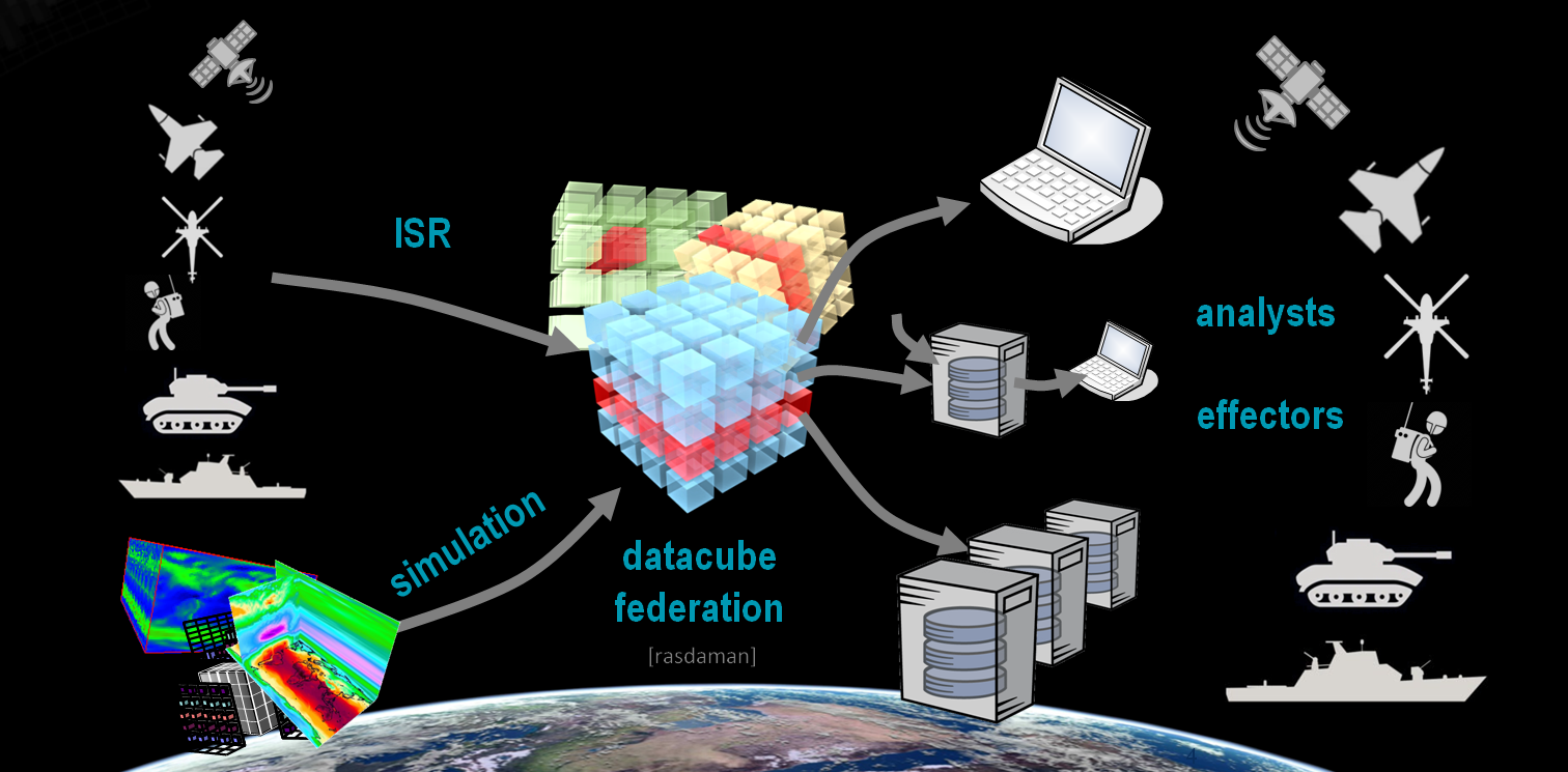
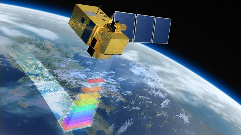
Cube4EnvSec responds to this capbility gap by demonstrating how humans and tools can exploit seamlessly federated, AI-enabled spatio-temporal datacube services. A paradigm of "any query, any time, on data anywhere" becomes reality, integrating fixed and moving geo data sources for use by fixed and moving consumers. Based strictly on open standards a plethora of clients can tap into the data resources for access, analysis, fusion, and federation.
As the optimally suited platform, the rasdaman datacube engine was chosen for its proven flexibility, scalability, and standards support.
Duration and Funding
The Cube4EnvSec project was in part funded by the NATO Science for Peace and Security (SPS) program, with a runtime from May 2022 through October 2024.
![]()
Scientific Advisor and NATO-Side Coordinator
LtCol Rene Heise (NATO-HQ) acts as scientific advisor and coordinator for this SPS-project. Heise works in NATO’s Emerging Security Challenges Division in Brussels, Belgium. Previously, he has served as head of Geo-sections at the German Air Force Air Operations Command and as acting Chief METOC Officer and Section Head at the NATO Allied Command Operations. He is a member of the Global Military Advisory Council on Climate Change.
Visitors
Datacubes
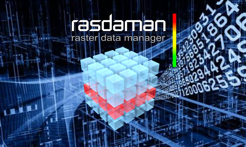
Huh? Datacubes?
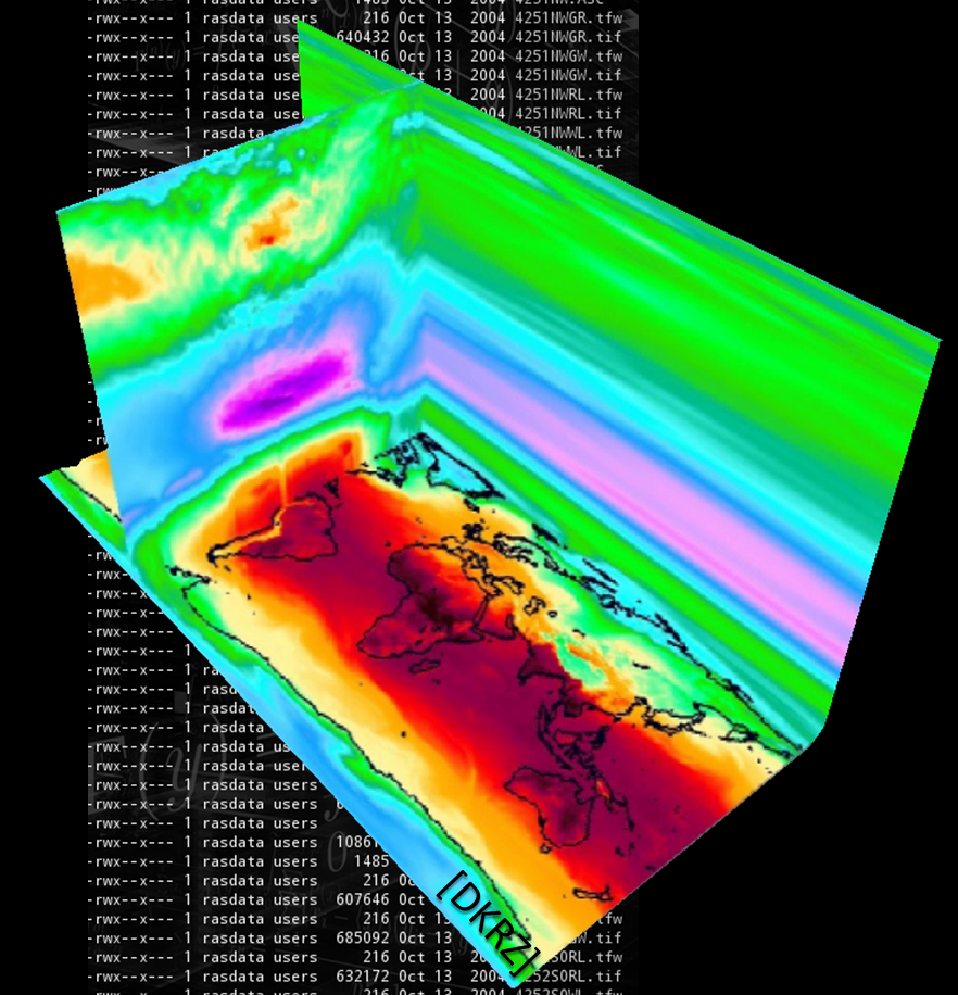
If you think about our atmosphere, do you think about zillions of NetCDF files? Probably not. You rather think of some 3D x/y/z space that changes over time - the fourth dimension, actually. Datacubes are intuitive and natural, simplifying wrangling of spatio-temporal data.
Multi-dimensional by Nature
Datacubes are not only 3D. They unify 1D sensor data, 2D imagery, 3D x/y/t image timeseries and x/y/z geological voxel data, 4D x/y/z/t atmospheric and ocean data, etc. Powerful, flexible standardized APIs as issued by OGC and ISO unify across all dimensions, simplifying access further.
Location-Transparent Federation
...establishes a single common information space where heterogeneous data sources feed homogenized datacubes for a flexible mix & match.
Curious? Try it Out!
Experience the award-winning, world-leading rasdaman datacubes hands-on with the Earth Datacube Playground!

Consortium
Cube4EnvSec consists of a nucleus to get the ball rolling; however, it is open to any other initiative that wants to relate itself to the spirit of Cube4EnvSec.
Constructor University, Germany
The Large-Scale Scientific Information Services Research Group (L-SIS) at Constructor University led by Prof. Dr. Peter Baumann, who is also Principal Investigator of Cube4EnvSec, researches on flexible, scalable services on massive multi-dimensional grid data (aka "datacubes"). L-SIS addresses this theme in all its aspects, including theory, architecture, and applications in science and engineering. One main outcome is rasdaman ("raster data manager"), the pioneer Array DBMS, which has has received a series of national and international innovation awards and has led to an internationally successful spinoff. Standardization is a second major substantial contribution.
In Cube4EnvSec, the group operates the weather and thunderstorm datacube services, and provides the link into the EarthServer datacube federation.
Tel Aviv University, Israel
Tel Aviv University (TAU) is Israel's largest and most comprehensive institution of higher learning, home to over 30,000 students in nine faculties and over 125 schools and departments across the spectrum of sciences, humanities and the arts.
Led by Prof. Dr. Colin Price, the Atmospheric Physics Lab has international reputation in research on atmospheric electricity, thunderstorms, space weather, sprites, climate change, and related topics.
In Cube4EnvSec, the group operates the lightning datacube service.
Greenland Institute of National Resources, Greenland/Denmark
Greenland Institute of Natural Resources is a research institution located in Nuuk organized under the Government of Greenland with an independent Board. The institute is advising the government concerning biological resources and the natural environment on the basis of field work sampling and measurements on land and at sea with small and larger vessels as platforms. The collected data is managed through databases and geospatial analytics, relevant data are stored in external agencies or organizations, such as ICES.
Karl Zinglersen, researcher at Greenland Institute of National Resources, is working on the mapping of Greenland towns and nature as well as Bathymetric mapping in the Arctic with GIS, Remote Sensing, land surveying methods.
In Cube4EnvSec, the group operates the maritime datacube service.
Aydin University Istanbul, Turkiye
Istanbul Aydin University is a private university founded in 2007 in Istanbul, Turkey by extension of its predecessor. The university is a technology center with ten faculties.
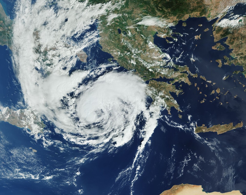
Prof. Dr. Zafer Aslan, Vice Rector at the Dept. of Computer Eng. in the Faculty of Engineering and Director of International Relations, together with her team researches on wind energy, spatio-temporal analysis of vegetation, and machine learning. In the project, focus is on hurricanes in the Mediterranean, so-called medicanes.
In Cube4EnvSec, the group operates the medicane datacube service.
Terms of Reference
Responsible Maintainer
|
Constructor University Bremen gGmbH c/o Prof. Dr. Peter Baumann Campus Ring 12 28759 Bremen Germany |
Contact: Peter Baumann,
Trademarks
"AI-Cube" is a trademark of rasdaman GmbH.
Image Credits
Images credits: AdobeStock, ESA, NATO, Heise, Mishev, rasdaman, DKRZ, WWF.
No Operational Use
This service is for technology demonstration purposes only. No responsibility whatsoever is taken on availability of the service, availability of data at some particular location and time, and correctness of the data. It is explicitly forbidden to base decisions, such as choice of flight path, on this demonstration service.
External Links
All external links implemented on this site have been checked for conformance with the spirit and intent of this site, and have found conformant at this time. However, the maintainer of this site has no control over the (change of) contents of the referred websites and, therefore, does not assume any responsibility for the contents of referred websites.
German Data Protection Regulation (GDPR)
The controller responsible for the described data collection and processing is named in the Constructor University imprint.
When you visit our website, the Web server temporarily stores usage information on our server machine (running in Germany) for statistical purposes in the form of a log in order to improve the quality of our website and to fulfill funding agency statistics reporting obligations. We do not transfer your personal data to third parties without your express consent.
When it comes to processing your personal data, the GDPR grants you certain rights as a website user:
- Right of Access (Art. 15 GDPR): You have the right to request confirmation as to whether personal data concerning you is being processed; where this is the case, you have a right of access to this personal data and to the information specified in Article 15 GDPR.
- Right to Rectification and Right to Erasure (Art. 16 and 17 GDPR): You have the right to immediately request the rectification of incorrect personal data concerning you and, if necessary, the completion of incomplete personal data. You also have the right to request that personal data concerning you be erased immediately if one of the reasons listed in Art. 17 GDPR applies in detail, e.g. if the data is no longer required for the purposes for which it was collected.
- Right to Restriction of Processing (Art. 18 GDPR): You have the right to request a restriction of processing for the duration of a review if any of the conditions specified in Art. 18 GDPR have been met, e.g. if you have lodged an objection to the processing.
- Right to Data Portability (Art. 20 GDPR): In certain cases (which are outlined in detail in Article 20 GDPR), you have the right to obtain from us your personal data in a structured, standard, machine-readable format or to request the transfer of such data to a third party.
- Right to Object (Art. 21 GDPR): If data is collected on the basis of Art. 6(1)(f) GDPR (data processing on the grounds of legitimate interests), you have the right to object to the processing at any time for reasons arising from your particular situation. If you make such an objection, we will no longer process your personal data unless we can demonstrate compelling legitimate grounds for the processing which override your interests, rights, and freedoms or for the establishment, exercise, or defense of legal claims.
- Right to Lodge a Complaint with a Supervisory Authority In accordance with Art. 77 GDPR, you have the right to lodge a complaint with a supervisory authority if you believe that the processing of your personal data violates data protection regulations. This right to lodge a complaint may particularly be exercised before a supervisory authority in the EU member state where you reside, work, or where you suspect that your rights have been infringed.